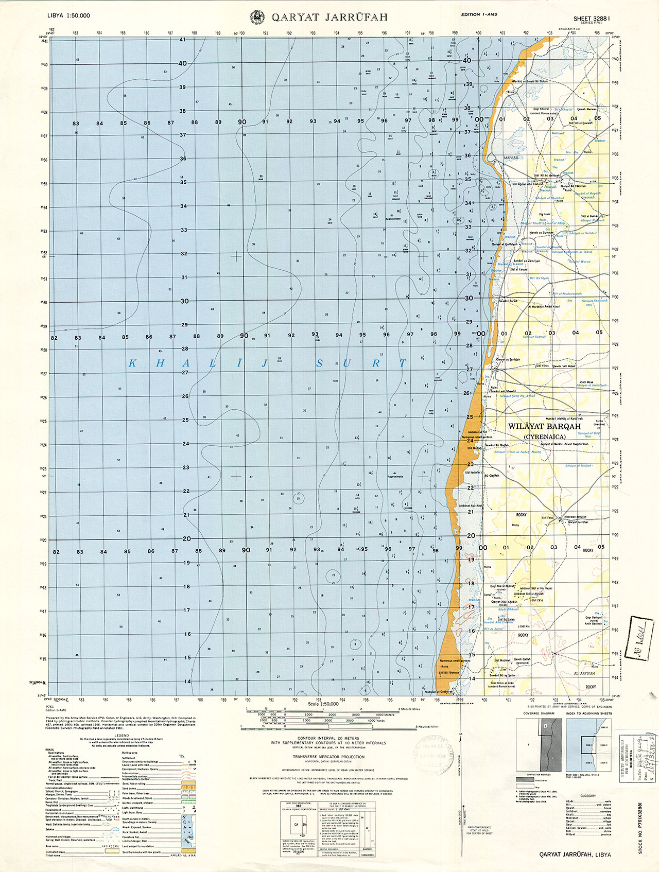
Qaryat Jarrufah
USA, Army Map Service
C.G. IAO
Libia 107
1011
3288 I
1:50 000
56x74
A Colori
Washington D.C.
Libia
1964
Series P761
United States Army Map Service
Prepared by the Army Map Service (KC), Corps of Engineers, U.S. Army, Washigton, D.C. Compiled in 1964 by photogrammetric methods. Coastal hydrography compiled from Italian Hydrographic Chart 467, printed 1954; 468, printed 1946. Horizontal and vertical control by 329th Engineer Detachment (Geodetic Survey). Photography field annotated 1961.